Comparison of seawater temperature of several observatories using EMODnet data
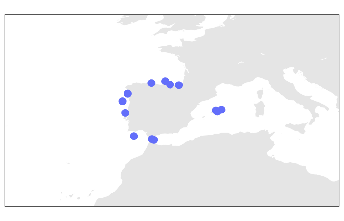
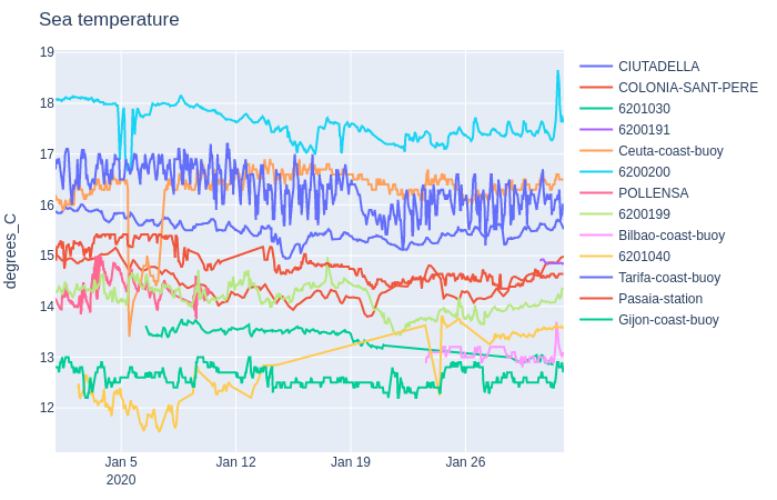
In this example, we have used data from EMODnet Physics. We have downloaded all the data from January 2020 from the observatories of the Spanish coast that measure the temperature of the water in the first 5 meters of depth. We have discarded datasets that contain errors (for example, misspelt geolocation). We have also dropped datasets with water temperatures at various depths or with large amounts of data so that the script could be run on less powerful computers. Finally, the files that we are going to use in this example are here.
import mooda as md
import plotly.graph_objects as go
import os

# Make a list of file locations
root = '/path/to/directory/'
nc_files = [os.path.join(root, filename)
         for root, _, filenames in os.walk(root)
         for filename in filenames
         if '.nc' in filename]

# Open the files and make a list of WaterFrames
wf_list = [md.read_nc_emodnet(path) for path in nc_files]

# Make an interactive map with the observatory locations
fig1 = md.iplot_location(wf_list)
go.Figure(fig1).show()

# Make an interactive plot with the seawater temperatures of all the WaterFrames
fig2 = md.iplot_timeseries(wf_list, 'TEMP')
go.Figure(fig2).show()
Output:


Note: The script makes two interactive charts. The images shown in this document have been generated by saving the interactive images in a PNG file.
Return to the Index of examples.